

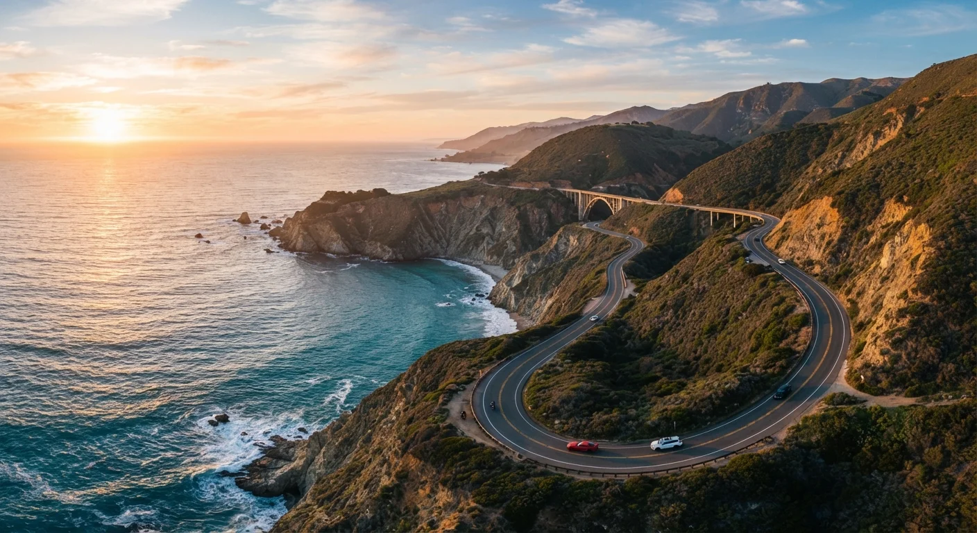
What Is the Pacific Coast Highway, Really?
The term "Pacific Coast Highway" gets used loosely, and that's one of the first things to clear up. Officially, California State Route 1 runs approximately 655 miles from Dana Point in Orange County to Leggett in Mendocino County. The stretch most travelers picture — sweeping cliffs, sea stacks, redwood fog — covers the central California coast, particularly the corridor between Morro Bay and Carmel-by-the-Sea that includes Big Sur.
Route 1 is occasionally referred to as "PCH" along its southern urban sections through Malibu and Santa Monica, while farther north it merges briefly with US-101 before breaking free again through the Mendocino coast. Understanding this patchwork helps you plan which segments to prioritize. If your time is limited, the roughly 90-mile Big Sur stretch delivers the most concentrated dramatic scenery.
For a broader look at how a coastal destination compares to other travel landscapes, see coastal towns versus mountain towns — geography really does shape everything about a trip.
The Route at a Glance: Distances and Time
Driving the full length of Route 1 without stopping would take roughly 14–16 hours of pure drive time. In practice, nobody does that — and nobody should. The road demands attention, the views demand stopping, and the towns demand exploration.
655 mi
Total length of California State Route 1
Running from Dana Point in Orange County to Leggett in Mendocino County along the California coast.
5–7 days
Recommended minimum trip length for the highlight run
Covering the Los Angeles to San Francisco coastal corridor with meaningful stops along the way.
~90 miles
Length of the Big Sur coastal stretch
The most dramatic and frequently photographed segment, running roughly between Morro Bay and Carmel.
A workable framework for first-timers: allow five to seven days minimum for the central California highlight run, typically structured as Los Angeles → Malibu → Santa Barbara → San Luis Obispo → Big Sur → Carmel → Santa Cruz → San Francisco. That's roughly 420–450 miles of coastal driving depending on your exact start and end points.
Build in at least a full day in Big Sur, ideally two. Distances between services — gas stations, restaurants, cell coverage — stretch significantly through that stretch, and you won't want to rush it.
Road Conditions and Driving Challenges
Route 1 through Big Sur is a two-lane road carved into cliff faces above the Pacific. It is scenic in a way that demands your full attention, which creates a real tension: the instinct to stare conflicts directly with the necessity of watching the road.
Road Closures Are a Real Possibility
Sections of Route 1 through Big Sur close without much warning after significant rain, landslides, or wildfires. Always verify current conditions via Caltrans before departing each leg of the trip. Build at least one buffer day into your itinerary to absorb an unexpected detour or delay — inland US-101 is the standard alternative when Route 1 is closed.
Landslides are a genuine and recurring hazard. Sections of the highway have been closed for months or even years at a time following major slides — most notably the Pfeiffer Canyon Bridge collapse in 2017 and the Mud Creek slide the same year, which together closed sections for well over a year. Before any trip, check Caltrans QuickMap (dot.ca.gov) for current closures. Conditions can change rapidly, especially in winter and spring.
The road also features tight curves, no shoulders in many sections, and occasional one-lane bridges. If you're new to highway driving generally, understanding high-speed road dynamics provides a useful foundation before you tackle mountain coastal terrain.
Key Stopping Points Worth Knowing
Rather than an exhaustive list of every viewpoint, these are the stops with the most practical or scenic payoff:
- Malibu and Point Mugu: Good warm-up driving with wide road, ocean access, and accessible beaches before the terrain gets demanding.
- San Luis Obispo: An underrated base town with lodging at a range of price points and easy access to Morro Bay and Montana de Oro State Park.
- Bixby Creek Bridge: One of the most photographed points on the entire highway. There's a small pullout — arrive early in the morning if possible to avoid crowds.
- Julia Pfeiffer Burns State Park: Home to McWay Falls, an 80-foot waterfall that drops directly onto a beach. Day-use entry is required; arrive early.
- Carmel-by-the-Sea: Compact, walkable, and strikingly beautiful. The beach here is free and dog-friendly.
- Santa Cruz: A natural endpoint for the dramatic coastal section, with the iconic boardwalk and strong local food scene.
Arrive at Bixby Creek Bridge before 8 a.m. if you want a clear shot and a moment of relative quiet — by mid-morning in summer, the pullout is jammed with vehicles.
This is one of the most-visited single points on Route 1, and the small pullout fills quickly. Early arrival transforms the experience.
Book Big Sur lodging as your very first reservation — before you finalize anything else about the trip.
Big Sur has some of the fewest lodging options per square mile of any major American tourist corridor, and availability disappears months out during peak season.
What First-Timers Consistently Underestimate
Beyond road conditions, several patterns catch first-time PCH drivers off guard:
- Drive time inflation: Google Maps estimates assume normal highway speeds. On Route 1 through Big Sur, 50 miles can take 90 minutes or more once you account for curves, pullouts, and construction zones.
- Fuel gaps: Between Cambria and Carmel, fuel is scarce and expensive where available. Fill the tank in San Luis Obispo or Cambria before heading north into Big Sur.
- Lodging scarcity in Big Sur: There are only a handful of lodging options within Big Sur itself, and they book months in advance in summer. Plan this segment first, not last.
- Cell coverage: Extended stretches of Big Sur have no reliable cell service. Download offline maps (Google Maps or Maps.me both support this) before you leave your last town.
- Fog timing: Morning fog along the coast is common, especially May through July — a weather pattern locals call "June Gloom." Afternoon often clears, so structure your driving and photo stops accordingly.
June Gloom Is Real — and Manageable
From late May through early July, a marine layer frequently blankets the coast each morning, sometimes lingering until early afternoon. This doesn't ruin a trip — it creates a moody, atmospheric light that many photographers prefer. Schedule driving for mornings and plan beach or viewpoint stops for the afternoon when visibility typically improves.
Planning Your Trip: Practical Logistics
A few structural decisions make the whole trip smoother:
Direction of travel: Southbound (San Francisco to LA) places your vehicle on the ocean side of the road, which many drivers prefer for the views. Northbound keeps you on the cliff-face side. Neither is wrong — it's a genuine preference call.
Seasons: Summer is peak season with predictable weather but heavy traffic, especially on holiday weekends. Spring (April–May) and fall (September–October) offer lighter crowds and often stunning clarity. Winter can be beautiful but brings elevated closure risk.
Vehicle choice: Any standard passenger car handles this route fine. You don't need a 4WD or anything special. Motorcyclists find the road excellent but should be especially aware of gravel debris in corners after rainfall.
If you're new to self-planned road trips altogether, a complete trip-planning roadmap walks through every stage from itinerary building to packing strategy.
The PCH rewards patience and preparation. Come with loose plans, a full tank, downloaded maps, and a willingness to stop when something looks extraordinary — because something always does.
Download Offline Maps Before You Leave
Cell service disappears for extended stretches through Big Sur. Before leaving Cambria or San Luis Obispo, download the relevant offline maps on your phone. It's also worth writing down the addresses of your next two or three stops, including your accommodation, in case your phone can't connect when you need it most.
The content on this site is for informational purposes only and is not a substitute for professional advice. Always consult a qualified professional for guidance specific to your situation.